Tuesday, April 7, 2020

June 11, 2018 Louisville, NE Tornado and Supercell

On Monday, June 11, 2018, I was working at the National Drought Mitigation Center on the first draft of that week's U.S. Drought Monitor. For most of the day, storm chasing was the last thing I was thinking about, as we pored over meteorological, hydrological, and satellite-based drought indices to update the USDM map. I knew in the back of my mind that there was a chance for severe weather in east-central and southeast Nebraska late that afternoon, but given how arduous of a task the USDM is, I did not give much thought to chasing in the morning, thinking that there was no way I'd have time. Providentially, we finished making our first round of edits for the initial map draft far earlier than I anticipated, and once I started realizing we were ahead of schedule, I took a quick glance at the SPC page and started to look at surface observations. A mesoscale discussion indicating the likely issuance of a tornado watch for eastern Nebraska made me more optimistic (since I was at work and working on USDM, I had very little time to look at any current weather data myself outside of areas where we were considering changes to the map).
Finished product on Wednesday for that week's US Drought Monitor. That week's author was Brian Fuchs, who I was working with that day.

When we finished the first USDM draft, I took a quick look at data in my office before leaving. While my memory is a little rough from this day, I recall there being a bit of an outflow boundary left behind by morning storms, draped west-to-east just to the south of the Omaha metro. A cold front was also coming into eastern Nebraska from the northwest, and this would initiate storms west-northwest of Omaha, though it was clear that these would likely become linear early on, and would probably have lower tornado potential. I drove east on US 34 out of Lincoln (with music from Twister playing on my car speakers, because why not?), and spotted organized cumulonimbus to my north. I guessed that the storm I was now targeting may have been rooted along the remnant outflow boundary.

From here on, my memories of this chase are a little fuzzy, but here's my best to accurately recount it:

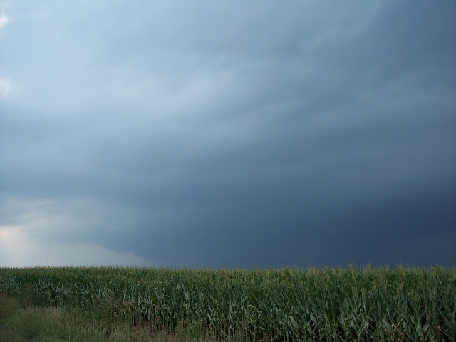
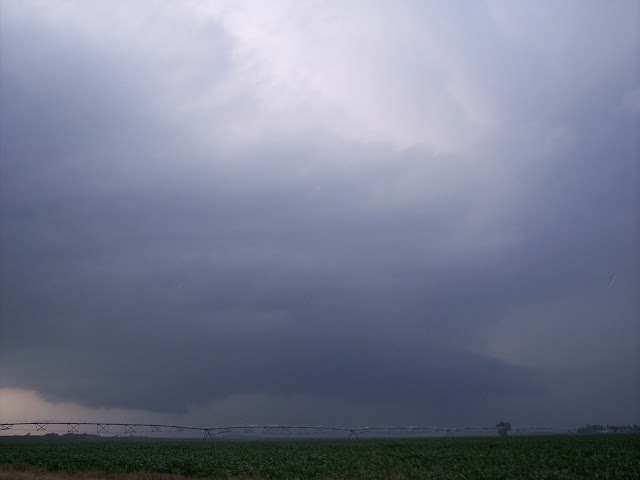
I was well south of the developing supercell south of Omaha for a while, traveling eastbound on US 34, until I arrived at the eastern end of Nebraska and US 75. From here, I went north, and I think I backtracked a bit west somewhere near Plattsmouth, NE, in order to get a better look at the structure of the very slow-moving supercell. While the low-level mesocyclone was still likely about 10 miles away, I could tell that the low-level rotation was gradually getting better organized. Despite all of the haze that afternoon, I had a decent view of the low-level structure from my vantage point (still roughly 10 miles from the storm). Photos below give you an idea of the structure:
Wall cloud, looking northwest

Wall cloud, perhaps funnel cloud, looking northwest
While looking to the northwest, I noticed a vertically oriented pillar of cloud suddenly form, which had contact with both the ground and cloud-base. I figured at the time that this may have been a tornado; I confirmed this later with reference to an NWS storm survey (compared to when the picture of this was taken, and based on close-up video taken by YouTube user Live Storms Media, linked here). This was the Louisville area EF-0 tornado, shown in the photograph below (it's low contrast, so hard to make out):

Louisville, NE tornado (rated EF0)
 After this tornado dissipated, I followed the storm as it slowly drifted east-southeast and gained more high-precipitation characteristics. While I did not see any other tornadoes, the storm did produce at least one other tornado about 50 minutes later, which I elaborate on in one of the photo captions. The HP structure was mesmerizing to watch slowly drift across the plains/lowlands of eastern Nebraska.


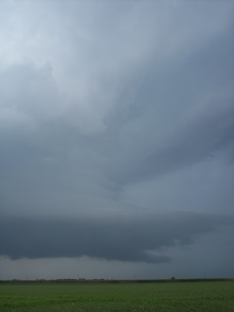
One or more tornadoes were occurring at about 6:30 CST when this picture was taken, and these were rated EF0. While chasing, I suspected that a tornado was taking place, due to the visually evident tightened low-level rotation, low-based cylindrical wall cloud, and rapid increase in the strength of the inflow, but due to the HP structure, I couldn't confirm a touchdown visually. I confirmed that there were tornadoes during this period a couple years later (while writing this entry) by sifting through storm survey data from this day and comparing it to time stamps on my photos. This photo captures the structure during this tornadic phase well.
Tornadic phase of supercell, with cylindrical wall cloud. The tornado(es) during this phase were rated EF0 (see above paragraph for details).

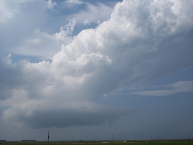
After this tornadic phase, the supercell became more outflow-dominant, and trailing storms along the cold front caught up to it. The resulting squall line surged ahead and produced widespread severe winds. At this point, I was quickly moving south to try to stay ahead of the storm (both me and the storm were headed southeast towards Nebraska City). At one point, a tornado warning was issued while the storm outflow was accelerating (likely due to a spin-up circulation somewhere along the gust front), and I pulled off on a gravel road to avoid where the area of rotation was purportedly going (car radio tornado warning announcements were quite useful for doing this).
Storm becoming outflow-dominant just north of Nebraska City
Once the gust front had passed, I made my way to NE highway 2, and drove back to Lincoln. When I returned home, I was treated to a gorgeous mammatus display under the anvils of the MCS which had developed by the time I got home. All-in-all, this was a fantastic chase day, considering that I saw one or more tornadoes along with beautiful supercell structure, I didn't have to go far from home, and I got a full day's work on the US Drought Monitor in, all on a day when I was not planning to chase when I got up that morning.


Mammatus display from my backyard (looking southeast)!

Saturday, January 28, 2017

Churches of the Great Plains

As a slight deviation from the normal format of this weather photo-journal/blog, I wanted to share photos of churches across the Great Plains. As a Catholic and a meteorologist, and as a landscape and photography enthusiast, I find the plains to be an underappreciated region of the United States, and the churches which populate its small towns and fields to be beautiful signs of God's enormous beauty in otherwise humble terrain.

Enjoy! I'll be adding to these as I take more photos.

 Raymond United Methodist Church (Raymond, NE)

Holy Trinity Catholic Church, Brainard, NE

Interior of Holy Trinity Catholic Church, Brainard, NE

St. Mary's Catholic Church, David City, NE
Interior of St. Mary's Catholic Church, David City, NE

St. Francis of Assisi Catholic Church, David City, NE
 Cemetery at St. Francis of Assisi, David City, NE, with high-based convection in distance

Interior of Assumption Catholic Church, Dwight, NE

Exterior of Assumption Catholic Church, Dwight, NE

St. Anselm Catholic Church, Anselmo, NE

Interior of Immaculate Conception Catholic Church, Leoville, KS

Interior of Immaculate Conception Catholic Church, Leoville, KS
Air Force Academy Chapel, US Air Force Academy Campus, Colorado Springs, CO


St. Mary's Catholic Church, St. Benedict, KS


St. Mary's Catholic Church, St. Benedict, KS


St. Mary's Catholic Church, St. Benedict, KS


St. Columbkille Catholic Church, Blaine, KS


St. Columbkille Catholic Church, Blaine, KS


St. John Nepumocene Catholic Church, Pilsen, KS (childhood parish of Fr. Emil Kapaun https://en.wikipedia.org/wiki/Emil_Kapaun)


Interior of St. John Nepumocene Catholic Church, Pilsen, KS


Sacred Heart Catholic Church, Colwich, KS


Interior of Sacred Heart Catholic Church, Colwich, KS


St. Mark's Catholic Church, Colwich, KS


Interior of St. Mark's Catholic Church, Colwich, KS


Holy Trinity Catholic Church, Okarche, OK (childhood parish of Bl. Stanley Rother https://en.wikipedia.org/wiki/Stanley_Rother)


Interior of Holy Trinity Catholic Church, Okarche, OK

St. Mary's Cathedral, Cheyenne, WY

St. Charles Borromeo Catholic Church, North Bend, NE

St. Mary's Catholic Church, West Point, NE
St. Joseph Catholic Church, Wisner, NE
St. Leonard Catholic Church, Madison, NE
St. Francis of Assisi Catholic Church, Humphrey, NE


Friday, December 11, 2015

July 26, 2014 Ulysses, NE Supercell

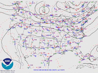
        This day started as a typical late summer day in the central Great Plains. A mesoscale convective system had formed early in the morning in central South Dakota, and from 9-11 a.m. was characterized by a leading convective region and a trailing transition zone and stratiform region. The MCS had formed on the southern edge of a shortwave trough propagating southeastward out of southern Saskatchewan and western North Dakota.
500 hPa isoheights, isotherms, and wind barbs (SPC archive).


        By noon, the thunderstorm complex had propagated into northeastern Nebraska, and the trailing stratiform region began to dissipate as the leading convective elements became more cellular. As evidenced by a special 18 UTC sounding from OAX, the environment over eastern Nebraska was characterized by weak low-tropospheric flow and moderate to strong deep layer westerly shear on the southern edge of the 500-300 hPa jet streak associated with the shortwave trough. The boundary layer below a moderate capping inversion was very warm and moist, with a surface temperature and dewpoint at OAX of 86/75 F. Above the inversion, near dry-adiabatic mid-level lapse rates were observed, leading to CAPE values in the 3000-4000 J/kg range. Given a discrete storm mode, the environment favored non-tornadic supercell thunderstorms in the northern two-thirds of Nebraska, where capping was weakest. See the observed 18 UTC OAX sounding at: http://www.spc.noaa.gov/exper/archive/events/20140726/soundings/14072618_SNDG/last.gif

        I departed Lincoln at about 1:30 p.m. northbound on NE-79, hoping to see a shelf cloud moving across the Bohemian Alps region northwest of Lincoln. Not having any mobile data on this day, all chase decisions were made by visual clues and paper maps. Sky cover was mostly cloudy as I traveled north towards Valparaiso, with little evidence of the organized convective complex which I had hoped would produce a photogenic shelf cloud. I headed west on NE-66 from Valparaiso, as the cumulonimbus towers had the strongest/most solid appearance to the northwest. As I entered Dwight, a large and robust updraft appeared to the west-northwest, as the low clouds which had been shrouding convective towers from view had abated. Figuring that the convective complex from earlier had lost organization, I decided to chase the strong looking updraft to the west, hoping that the lush vegetation and gently sculpted landscape would provide interesting contrast to what I believed were multicell storms to my west-northwest.

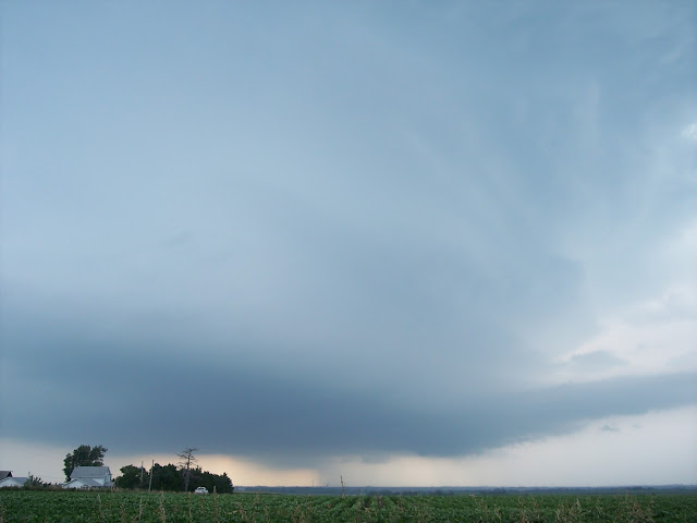
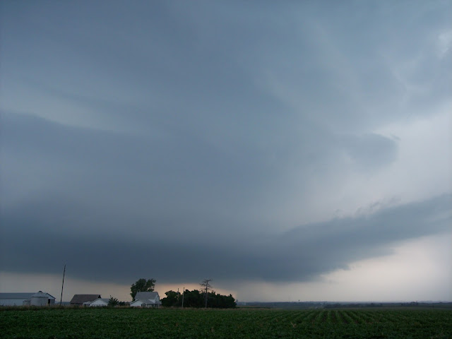
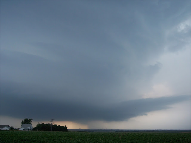
        When I pulled off of NE-12C a few miles east of Ulysses, a wide, striated mesocyclone came into view.
Mesocyclone west of Ulysses, NE


Mesocyclone west of Ulysses, NE

Not surprisingly, no low-level mesocyclone appeared to exist, likely due in part to the anemic low-level shear. Nevertheless, the storm structure was spectacular (particularly given the low expectations which I had when leaving my apartment).
Mesocyclone west of Ulysses, NE


        Shortly after the second photo was taken, widely spaced large drops and small hailstones began falling, as the near-updraft forward flank precipitation core moved south-southeast over me. Later that afternoon, I found out that 4.25" diameter hail had been reported to my southeast near when the above pictures were taken. I quickly re-positioned to the east and followed the storm as it moved to the south-southeast, stopping to photograph it again along NE-15 just to the south of I-80. By then, the updraft had narrowed (and likely weakened some), though it still had a sculpted appearance, as well as some evidence of a wall cloud and low-level inflow tail.  Photography along NE-15 was particularly difficult, as corn stalks had become tall enough to obscure low-level storm features from view, thus limiting the number and quality of pictures of the storm as it was weakening.
The corn was too tall! 

Low-level updraft and tail cloud south of I-80 on NE-15


Low-level updraft and tail cloud south of I-80 on NE-15


        As the updraft was moving too close to capture its full extent, I adjusted south to Dorchester. About 10-15 minutes after the above pictures were taken, the updraft had narrowed and weakened considerably, and exhibited a severe downshear tilt.
Rapidly weakening updraft north-northwest of Dorchester, NE


Downshear tilted updraft north-northwest of Dorchester, NE


Rapidly weakening updraft north-northwest of Dorchester, NE
       The formerly supercellular updraft had dramatically weakened (likely due to the stronger cap in southeast Nebraska), and no longer appeared to be producing any precipitation. Roughly 20 minutes later, after I had turned eastward towards US 77 to head back to Lincoln, all cloud cover which had been associated with the supercell completely dissipated.

        This chase remains one of my favorites for several reasons: 1) Few other chasers were observing this storm, meaning that the roads were mostly devoid of traffic (as opposed to a handful of other Nebraska chases in 2014 which involved roads jam-packed with storm observers), 2) I had to rely on visual clues and my meteorological knowledge of the synoptic and mesoscale environment in order to successfully chase storms. Particularly after many frustrating, high stress chases earlier in the spring, this was a welcome experience that was likely similar to ones early storm chasers would have had in the 1970s-1990s, before mobile phone technology became widely available, and 3) I was blessed to witness the latter half of a supercell's life span (from mature stage to complete dissipation), something I hadn't seen before, and have not seen since.

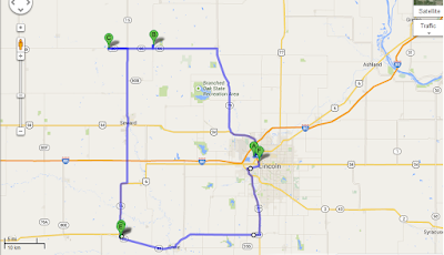
Chase route